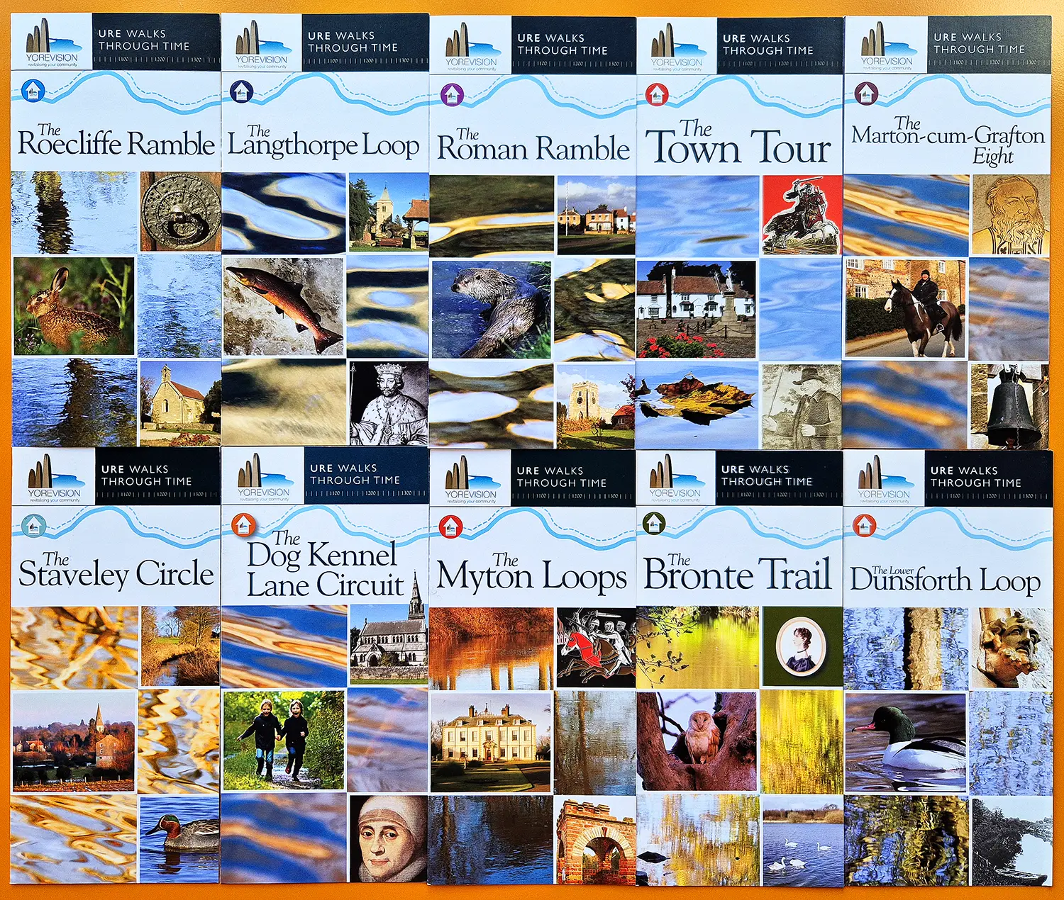
A series of interpretation panels and supporting printed leaflets developed for a network of walking routes across the Ure Valley, including Boroughbridge, Great Ouseburn and surrounding villages.
Our work focused on creating a clear and consistent interpretation system that brings together multiple circular walks under a unified identity. The aim was to help visitors and local users understand the landscape as they move through it, revealing layers of heritage, settlement and natural change along the River Ure.
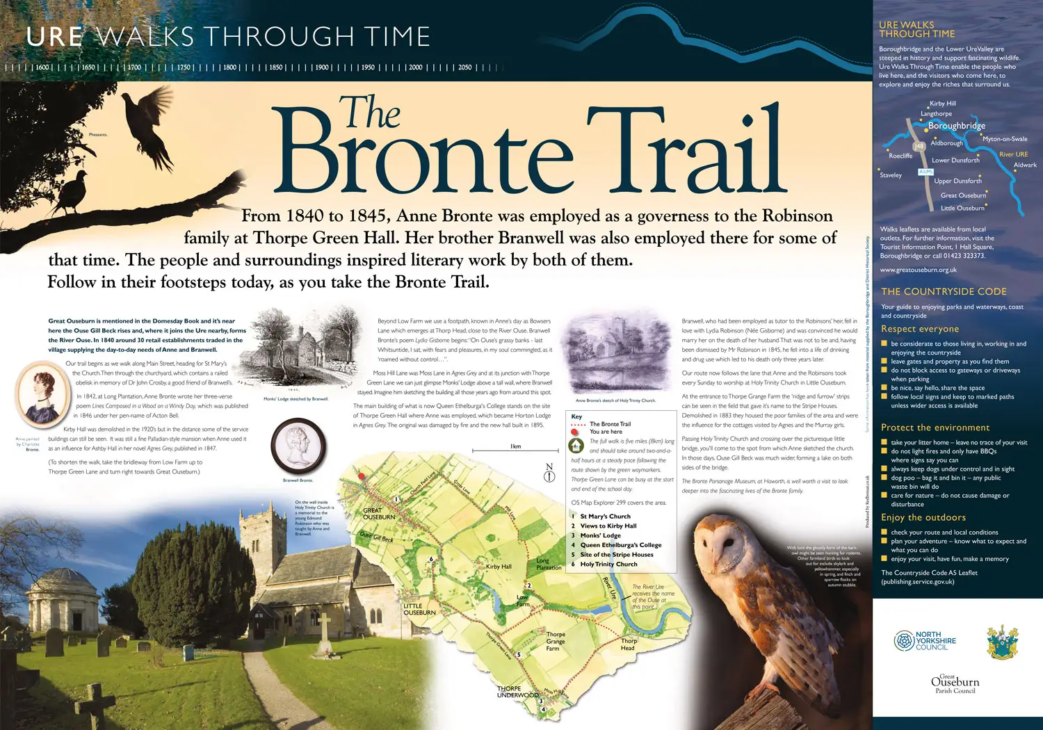
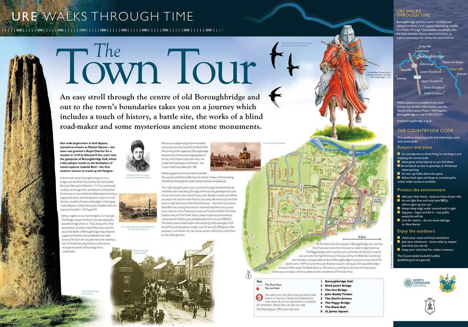
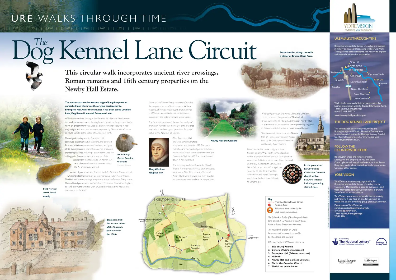
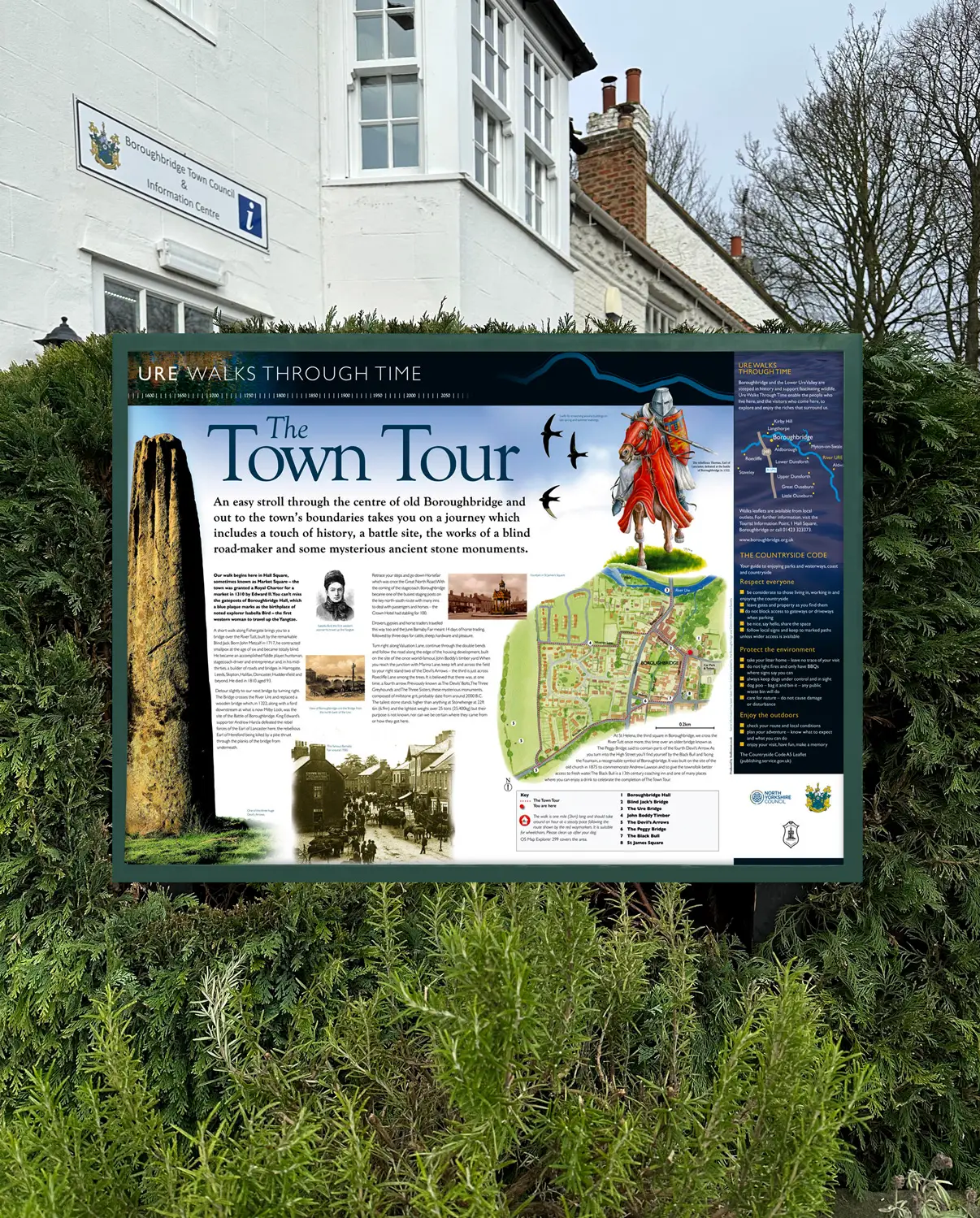
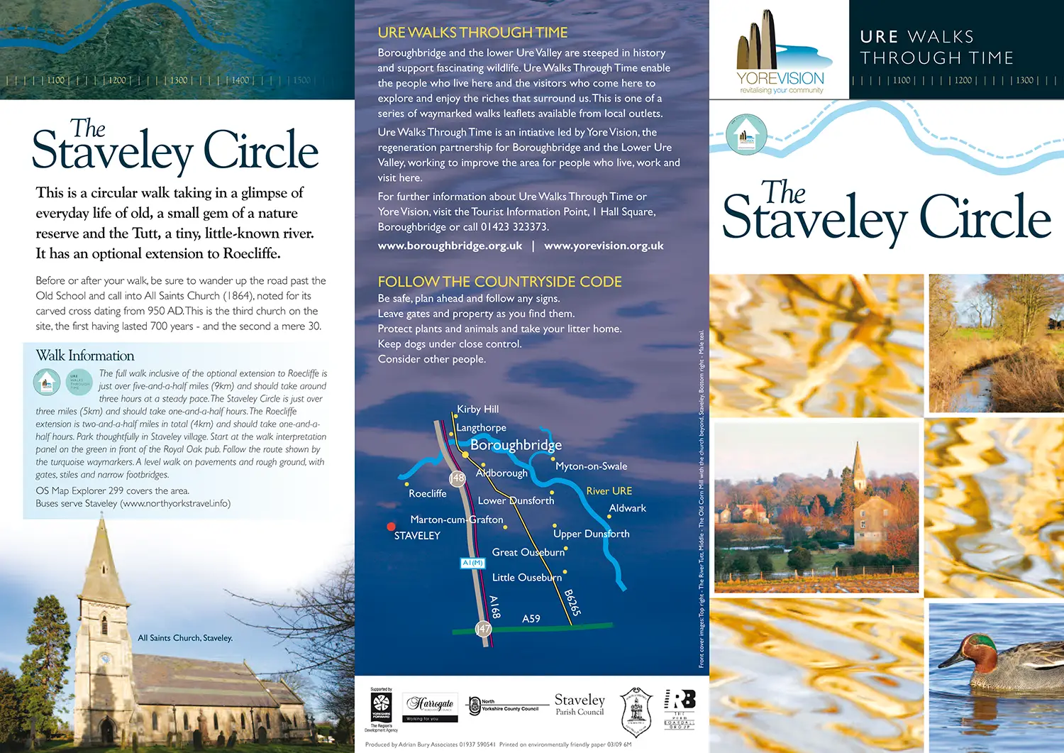
Each route has its own character and narrative, reflected through carefully structured interpretation panels and illustrated maps. These combine accessible storytelling with practical information, supporting navigation while enriching the experience of the landscape.
Alongside the on-site panels, we designed a suite of supporting leaflets for each walk. These extend the interpretation beyond the physical site, providing clear route guidance and additional context that encourages exploration across the wider area.
The result is a cohesive family of interpretation that connects individual walks into a broader story of place — linking river, town and countryside through a consistent visual and narrative approach.


